From the Road Conference in Brno, our PhD student is bringing home 1st place for the best dissertation.

Šimon Genzer, a graduate of our faculty, has been working at ČD Cargo, a.s. as an application developer for almost a year.

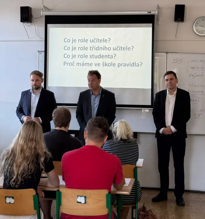
The Academic Senate of the CTU Faculty of Transportation Sciences has announced the election of the Dean for the term from February 1, 2026, to January 31, 2030.
20.-21. October 2025
Bratislava, Hotel Saffron
23.-24. April 2026
Praha, Česká republika
The Faculty of Transportation offers a wide range of study programs covering all areas of transportation. Whether you are interested in railways, aviation, road transport, or logistics, you will find the right program with us.
Discover the world of transportation through innovative and practically oriented programs.
Take your knowledge to the next level with our master's programs.
Kickstart your journey to scientific discoveries and deeper understanding of transportation.


Imagine a place where not only transportation develops, but also your visions of the future.
In our laboratories and specialized workplaces, we are not afraid to dive into the unknown, whether it is in the field of transportation optimization, autonomous vehicles, railways, designing effective measures, or sustainable transportation solutions.
Studying at the Faculty of Transportation of CTU is not just about theory. Our students experience a unique project-based learning concept that allows them to change the world of transportation even before they graduate. Take a look at some interesting projects we are working on at the faculty.